Sunday, December 23, 2012
Saturday, December 22, 2012

Tuesday, December 18, 2012
Thursday, December 13, 2012

Wednesday, December 12, 2012

Sunday, December 9, 2012
Saturday, December 1, 2012

Wednesday, November 21, 2012

Sunday, November 18, 2012

Wednesday, November 14, 2012

Sunday, November 11, 2012

Wednesday, November 7, 2012

colden valley: blue flowers, may
Bluebells in the valley bottom. Spring 2012.

colden valley: blue flowers, may, a photo by phil openshaw on Flickr.
colden valley: blue flowers, may, a photo by phil openshaw on Flickr.
Sunday, November 4, 2012
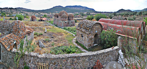
Rock Near Heptonstall
The hill between Hebden Bridge and Heptonstall is a mass of old quarry workings. The stone was extracted to build the nearby towns and villages. Today they mainly look like natural cliff faces.

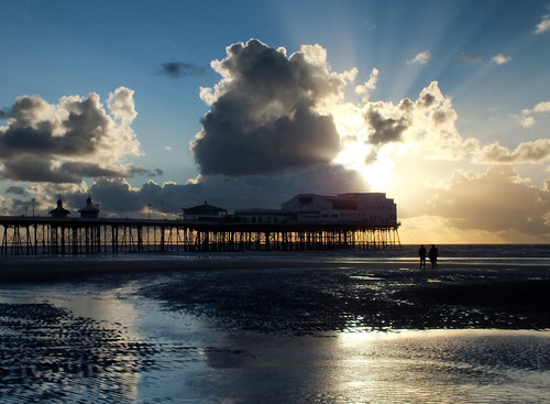
Blackpool: end
This one was taken to 'pair' with the image below.
Blackpool: end, a photo by phil openshaw on Flickr.
Blackpool: end, a photo by phil openshaw on Flickr.

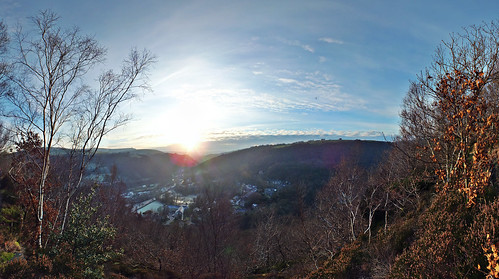
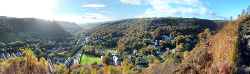
Over Bankfoot autumn 2012
Composite panoramic photo looking west away from Hebden Bridge.
Over Bankfoot autumn 2012, a photo by phil openshaw on Flickr.
Over Bankfoot autumn 2012, a photo by phil openshaw on Flickr.
Saturday, November 3, 2012
Blackpool: last day of autumn half term holiday 2012
North Pier Blackpool. Panoramic composite 01-11-12.
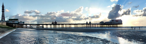
Blackpool: last day of autumn half term holiday 2012, a photo by phil openshaw on Flickr.
Blackpool: last day of autumn half term holiday 2012, a photo by phil openshaw on Flickr.
Sunday, October 28, 2012
over mytholm
Composite HDR picture taken from the quarry paths below Heptonstall.

over mytholm, a photo by phil openshaw on Flickr.
over mytholm, a photo by phil openshaw on Flickr.
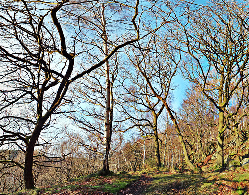
eaves wood- autumn 27-10-2012
Distorted trees on the slope down to colden valley.
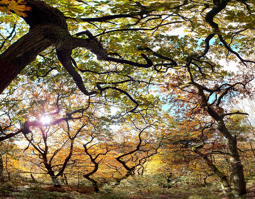
eaves wood- autumn 27-10-2012, a photo by phil openshaw on Flickr.
eaves wood- autumn 27-10-2012, a photo by phil openshaw on Flickr.
great-rock 27-10-2012
View of great rock from the upper side. Composite semi panoramic photograph.

great-rock 27-10-2012, a photo by phil openshaw on Flickr.
great-rock 27-10-2012, a photo by phil openshaw on Flickr.
Wednesday, October 24, 2012
near sandy gate lane
Path at the end of Nutclough woods leading to Wadsworth - Chiserley.

near sandy gate lane, a photo by phil openshaw on Flickr.
near sandy gate lane, a photo by phil openshaw on Flickr.
Sunday, October 21, 2012

Saturday, October 20, 2012


Saturday, October 13, 2012

Wednesday, October 10, 2012
Noah dale
Desolate? This was one a place where people lived....
Noah Dale dam was built by James King, the owner of Mytholm Mill, and Gamaliel Sutcliffe, owner of the Lumb Mills, probably in about 1806.
In 1825 Gamaliel Sutcliffe wrote a letter in which he says that some of the mills have used coal for steam but that this will soon come to an end because 'Nodale' dam was being enlarged at the cost of £200-300.
In 1935 there was a report that the dam had been leaking, and when inspected the following year it was stated that the dam was empty. The capacity of the dam was estimated to be 8-10 million gallons with a gathering ground of 300 acres.
The Noah Dale area was quite well populated at this time. Many of these people combined handloom weaving with farming. In 1830 it was proposed to have a Sunday school in ‘Nodale’ and about 67 children were expected to attend.

noah dale, a photo by phil openshaw on Flickr.
Noah Dale dam was built by James King, the owner of Mytholm Mill, and Gamaliel Sutcliffe, owner of the Lumb Mills, probably in about 1806.
In 1825 Gamaliel Sutcliffe wrote a letter in which he says that some of the mills have used coal for steam but that this will soon come to an end because 'Nodale' dam was being enlarged at the cost of £200-300.
In 1935 there was a report that the dam had been leaking, and when inspected the following year it was stated that the dam was empty. The capacity of the dam was estimated to be 8-10 million gallons with a gathering ground of 300 acres.
The Noah Dale area was quite well populated at this time. Many of these people combined handloom weaving with farming. In 1830 it was proposed to have a Sunday school in ‘Nodale’ and about 67 children were expected to attend.
noah dale, a photo by phil openshaw on Flickr.

stoodley
This is taken from just outside Old town looking towards Stoodley pike,

stoodley, a photo by phil openshaw on Flickr.
stoodley, a photo by phil openshaw on Flickr.
Sunday, October 7, 2012


Sunday, September 23, 2012
Colden valley- traces
Remains of mill buildings are much more visible aling the valley bottom due to flood erosion during the summer.

Colden valley- traces, a photo by phil openshaw on Flickr.
Colden valley- traces, a photo by phil openshaw on Flickr.

Monday, September 17, 2012

Saturday, August 25, 2012
ravenscar
Taken from the sight of the non existent seaside resort of Ravenscar looking north, The large low cloud is over Robin Hoods bay.
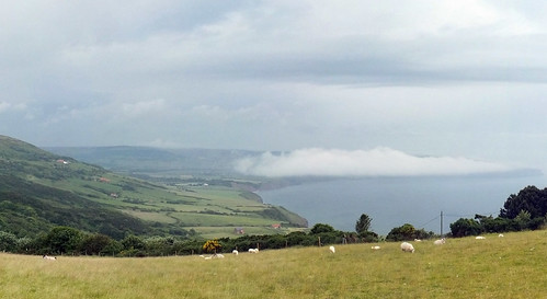
ravenscar, a photo by phil openshaw on Flickr.
ravenscar, a photo by phil openshaw on Flickr.
Monday, August 20, 2012


Sowerby Bridge: Moorings
Composite panorama of Sowerby Bridge canal moorings. August 2012.

Sowerby Bridge Moorings, a photo by phil openshaw on Flickr.
Sowerby Bridge Moorings, a photo by phil openshaw on Flickr.
Saturday, July 21, 2012

Thursday, July 19, 2012
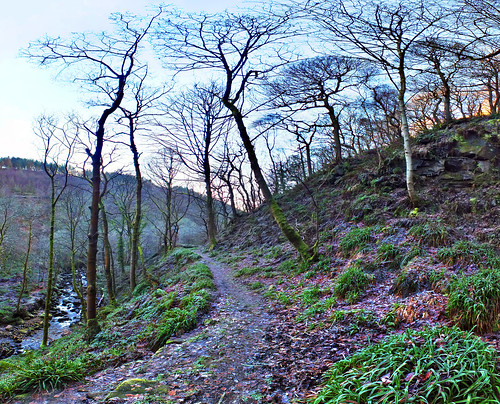
Trees: Quarry path to Heptonsall
2012 could be the worst uk summer ever, but there are some amazing shades of green out there.

Trees: Quarry path to Heptontsall, a photo by phil openshaw on Flickr.
Trees: Quarry path to Heptontsall, a photo by phil openshaw on Flickr.
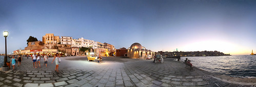
land-sea-sky-cornwall
Taken near Goran Haven. This is a section of a full 306 panorama with perspective adjusted for flattening out.

land-sea-sky-cornwall, a photo by phil openshaw on Flickr.
land-sea-sky-cornwall, a photo by phil openshaw on Flickr.
Friday, July 13, 2012
Hebden Bridge marina: autumn
From the canal looking towards New Road Hebden Bridge on a sunny weekend in early autumn 2011.

Hebden Bridge marina: autumn, a photo by phil openshaw on Flickr.
Hebden Bridge marina: autumn, a photo by phil openshaw on Flickr.